主要内容
预览文档 小型四轴无人机在城市局部区域三维测绘建模中的应用,是当前航测技术研究的重要方向。这篇论文系统探讨了无人机操作、传感器选型、测绘系统构建以及数据处理与传输等关键环节,为区域三维建模提供了完整的技术参考。文档类型为学术论文,适合无人机测绘领域的学生、研究人员及工程技术人员阅读,可帮助读者快速理解倾斜摄影相比传统垂直航拍的优势,并指导实际项目中的方法选择。
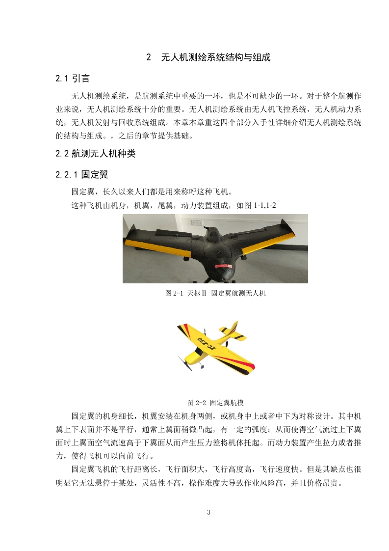
在无人机系统设计方面,论文重点分析了小型四轴飞行器的稳定性与载荷能力,并针对城市局部区域的高精度测绘需求,推荐了适配的倾斜相机传感器。通过对比传统垂直航拍与倾斜摄影两种数据采集方式,论文指出:倾斜摄影能够更真实地反映物体周围的环境细节,且生成的数据量更小。这一结论基于实际采集数据的对比分析,验证了倾斜摄影在三维建模中的高效性与准确性。
论文还详细阐述了从数据采集到三维模型生成的完整流程,包括飞行路径规划、多角度影像获取、点云处理及模型重建。其中,倾斜摄影通过一次飞行即可获取多个视角的影像,大幅减少了外业工作量,同时避免了垂直航拍因视角单一导致的建筑物侧面信息缺失问题。对于城市局部区域的三维测绘,倾斜摄影在效率与精度上均优于传统方法。
总体而言,这篇论文系统梳理了无人机三维测绘的技术路线,并通过实验对比明确了倾斜摄影的实用价值。读者可依据文档中的方法选择与参数建议,直接应用于城市局部区域的测绘建模项目,从而提升数据采集的完整性与建模效率。文档内容严谨,结论明确,是无人机航测领域的重要参考资料。
第1页 / 共31页
第2页 / 共31页
第3页 / 共31页
第4页 / 共31页
第5页 / 共31页
第6页 / 共31页
第7页 / 共31页
第8页 / 共31页
试读已结束,还剩23页,您可下载完整版后进行离线阅读
付费资源
© 版权声明
文章版权归作者所有,未经允许请勿转载。
THE END

暂无评论内容