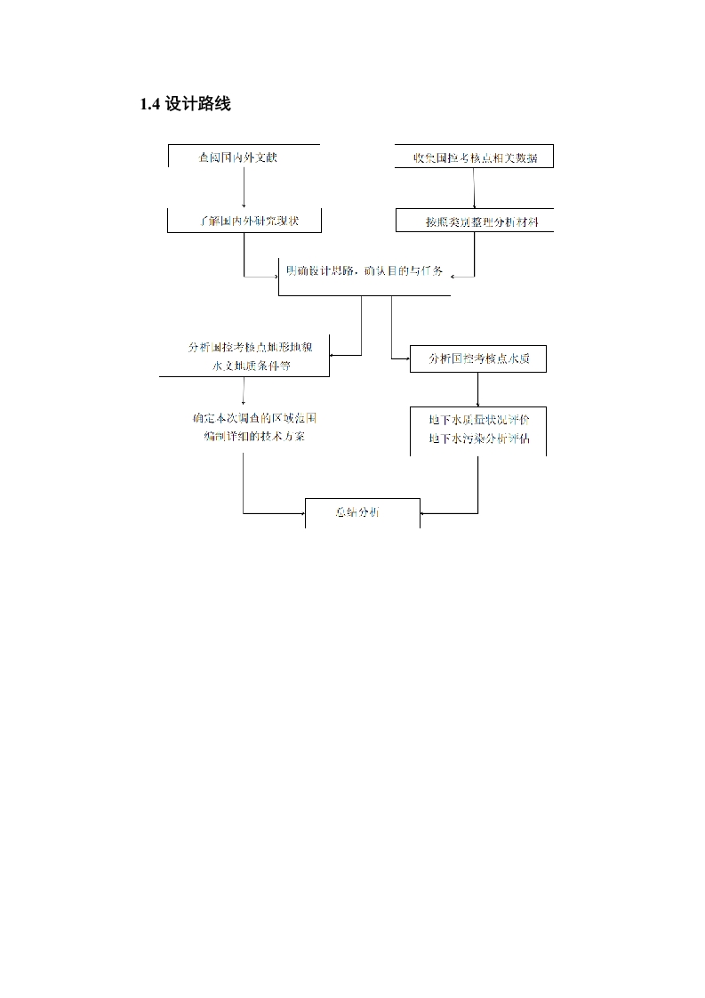
摘要本次设计通过收集分析济宁市某国控考核点位周边概况、历史监测数据、地质与水文地质等基础资料,并结合现场踏勘与人员访谈,确定该点位调查范围。在此基础上,依据调查目标和任务,遵循有关原则和要求,对调查区进行地下水调查设计。主要运用水文地质测绘、监测布点及采样测试等技术方法,用以探测调查范围内地下水类型、水质状况、水位动态等水文地质状况:查明调查区内污染源的种类、分布及对地下水潜在污染。以期为该国控点地下水质量评价报告编制提供技术支撑。关键词:济宁市某国控点:地下水调查设计:地下水监测ABSTRACTIn this paper This design determines the survey scope of a certainstate-controlled assessment point by collecting and analyzing basic data such assurrounding overview,historical monitoring data,geology and hydrogeology of astate-controlled assessment point in Jining,and combining on-site investigation andpersonnel interviews.On this basis,according to the investigation objectives and tasks,and in accordance with the relevant principles and requirements,the groundwatersurvey design of the survey area is carried out.Hydrogeological mapping,monitoringdistribution and sampling testing are mainly used to detect hydrogeological conditionssuch as groundwater type,water quality status,and water level dynamics within thesurvey scope.Identify the types and distribution of pollution sources and potentialcontamination of groundwater in the investigation area.In order to provide technicalsupport for the preparation of groundwater quality assessment reports for controlpoints in China.Key words:Jining City State Control Point;Groundwater monitoring:Groundwatercontamination目录1.绪论1.1选题依据1.2国内外研究现状51.3目的与任务61.4设计路线.…...00..0000.00072.研究区域概况…72.1位置..72.2考核点周边水文地质状况92.3区域自然地理概况102.4考核井点历史水质」143.方案设计153.1设计原则和依据153.2调查方法…173.3技术路线…173.4调查设计。173.5预期成果214.组织管理和保证措施.214.1.组织管理214.2.质量保证和安全施工措施.22结论.23参考文献.24致谢。.26

格式-17714f79fe-doc-1.webp)


暂无评论内容